Tortoise
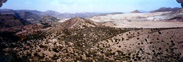
And then dunes. Gravel dunes. Close up not at all pretty. More like a building site. The mountains were red, brown, black, grey, blue. It was impossible to capture them through the camera. Then the mountains turned to a beautiful shade of golden red. This was an old pre-Colombian Indian trail from the Colorado River towards the coast. The vultures circling overhead had now disappeared. Time was against me and I was thinking I’d be spending the night outdoors in the desert. Then the road dropped.
I had passed between Black Mountain (and it is) and Imperial Gables. On my right hand side was an enormous mine. The Mesquite Gold Mine. Downhill all the way to Glamis on a shoulder I didn’t have for the previous 20 miles. After going up and down the dunes for so long this was a welcome break.
To my right for the 10 miles down was a fence saying it was a tortoise habitat and that they should not be harassed. You’d have to climb the 8 foot barbed wire fence and find them first. I saw none.
This is an excerpt from Algodones Dunes - Part 79 of the journal of my cycle across America, posted on IrishKC.
More Bicycle Touring Notes
• A Lot Less Scenic (Part 78)
• Beyond Hope (Part 77)
• Dust Devils (Part 76)
• A Frog (Part 75)
• Left Leg (Part 74)
• A Superior Cycle (Part 73)
• Photo: Arizona
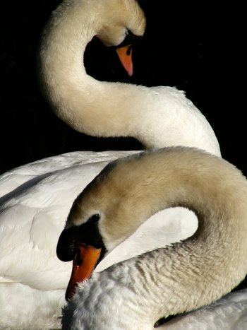
Photo: S is for Swan
Across the road from the entrance to where my studio is, there’s a family of these fellas that I’m happy to take a break from walking so as to watch.
As ridiculously cute as the babies in their appearance and movement are, the parents are simply dazzling in their graphic simplicity. Not that I could tell them apart from any other swans mind you.
More Animal Photos
• Studio Animal Life
• Dublin, A Horse
• Stag, Jackdaw
• Loads of Photos
A Lot Less Scenic
The clouds had made the day a lot less scenic than it could’ve been. In the distance (from as little as 5 miles away) mountains were only feint lines. Closer up they were as fabulous in California as in Arizona and New Mexico. Sometimes they look like big sleeping animals and other times, like the Big Maria Mountains, they’re all jagged and rocky. There was a mountain top in that range that looked just like a dog’s bottom row of teeth. In between the Big Marias and the Riverside were sand dunes. I’m supposed to go past much more of them today
This is an excerpt from California - Part 78 of the journal of my cycle across America, posted on IrishKC.
More Bicycle Touring Notes
• Beyond Hope (Part 77)
• Dust Devils (Part 76)
• A Frog (Part 75)
• Left Leg (Part 74)
• A Superior Cycle (Part 73)
• A Definite Event (Part 72)
• Photo: Arizona
Beyond Hope
Harcuvar is Mojave for “sweet water” not that I could see any. It used to be a station on the Parker branch of the Atchison Topeka & Santa Fe railroad. It’s also known as “Mountain Pass” after the mountain pass truck stop, which used to be very busy when Highway 60 was the main route between Phoenix and L.A. (before I-10).
I couldn’t see anything that might lead to the Indian petroglyphs so I just cycled on through the pass. It was downhill and through a heap of gravely hills with Saguaros all around. This is Granite Wash Pass. When you come through you drop into the town of Hope. I say town but like all the others it’s just a couple of buildings and an RV park which makes it look much bigger. I stopped and loaded up with water and some chocolate.
Leaving the town on State Highway 72 a large sign said “Your Now Beyond Hope” [sic]
This is an excerpt from Somewhere, Arizona - Part 77 of the journal of my cycle across America, posted on IrishKC.
More Bicycle Touring Notes
• Dust Devils (Part 76)
• A Frog (Part 75)
• Left Leg (Part 74)
• A Superior Cycle (Part 73)
• A Definite Event (Part 72)
• Photo: Arizona
Dust Devils
In Aguila, which is a mining town, I stopped at a cafe and had the special - a bowl of stew. When you’re hot and thirsty eating hot stew is very odd. So I had a couple of cokes at the same time. This was almost a nothing town and yet it had 3 motels - which augured well for the road ahead.
The road was now down on the desert floor again so it was level and straight. My speed picked up. The town of Gladden was just an RV park. This was the Aguila Valley with the Harcuvar Mountains lining the valley to the south and the Harquahala Mountains to the north.
At one point I saw 8 dust devils at once - all in the same area. I stopped and watched them. Most eventually dissipated after moving on. One got very fast and very marked. Another had a base of from 12 to 15 feet. Overhead frequently was the gentle mumble of a jet. In the clouds I couldn’t see anything but suspected it was the airforce.
This is an excerpt from Southwest Dreams - Part 76 of the journal of my cycle across America, which I posted today on IrishKC.
More Bicycle Touring Notes
• A Frog (Part 75)
• Left Leg (Part 74)
• A Superior Cycle (Part 73)
• A Definite Event (Part 72)
• Photo: Arizona
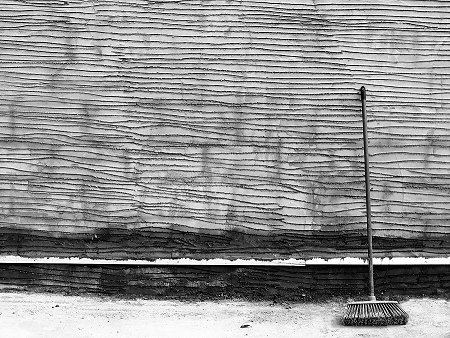
Photo: Pebble Dash Preparation
Shapes, patterns, lines, you know that I see them everywhere and extract them for paintings. And you know that I also like walls so much that I can look at them forever. Well I couldn’t look at this one like this forever because this was the final stage before the pebble dashing began.
More Photos of Shapes and Patterns
• White Head, Blue Sky
• Smithfield Cobblestones
• Runners, Rook
• Great Drying Weather
A Frog
I kept stopping every couple of miles and limping around and sitting down. Then I assumed that there was a pain barrier and tried going through it but I couldn’t. I grimaced a lot and screamed out loud a fair bit. I simply had to acknowledge that if my leg cannot bend then I can’t cycle anywhere.
Before California, before the 5,000 mile mark, I might well have to consider stopping. I did a lot of pedalling with one leg but it’s trickier in traffic. I reckoned I looked like a frog with one back leg.
This is an excerpt from Leaving Phoenix - Part 75 of the journal of my cycle across America, which I posted today on IrishKC.
More Bicycle Touring Notes
• Left Leg (Part 74)
• A Superior Cycle (Part 73)
• A Definite Event (Part 72)
• Photo: Arizona
Left Leg
The left leg went after 4 miles. I struggled on for 2, took 2 Tylenol, struggled on, but it got worse and eventually had to stop.
I used several excuses to stop: an ATM to get cash on my VISA card, but it refused adding to my list of concerns; a telephone cheapo job to ring somebody; and every single red light. I sat at the side of the road and sometimes tried walking slowly. No luck, I was limping badly.
I cycled with one leg but I wasn’t getting very far, and it’s cumbersome doing that amongst traffic. I screamed a few times. I gritted my teeth and grimaced a lot. I only had 2 more Tylenol (extra strength) left. To take them is to double the recommended dosage but if they’re not effective then there’s no point in keeping them. I swallowed them, the pain eased and I could make the leg pedal. 2 and a half miles from the door it returned but in familiar surroundings I just gritted and limped in.
This is an excerpt from Valley of the Sun - Part 74 of the journal of my cycle across America, which I posted today on IrishKC.
More Bicycle Touring Notes
• A Superior Cycle
• A Definite Event
• Photo: Arizona
Cycle Tour Photo: Arizona
Here’s a snap from my Cycle Across America photo album. I haven’t even taken the picture out of the album - so you’re looking at a photo of a photo behind plastic. Anyway, I’m just posting it because it goes with the words from the section of the trip I posted yesterday - a day that was mostly impossible to capture in pictures.
This was taken from US Route 60 to the north somewhere in the region of Globe and Miami, in Arizona around about where I entered the Tonto National Forest.
More Travel Posts:
• Angkor Wat, Cambodia
• A Definite Event
• Graffiti, Genoa, Italy
• Loads of Photos
A Superior Cycle
The descent to Superior was exhilarating. More so than into New York City.
It was so many factors. The rocks were now orange and elongated into almost column shapes. The slope down was 7% and on the feared shoulderless single lane. I was going from 30 to 37mph. To my side was a wall of beautiful rock, or a barrier protecting me supposedly from a fall into a deep canyon. This was called Devil’s Canyon.
The road was still twisting and turning as it clung to the side of the canyon. I was trying to watch the road ahead, look up at the spectacular views and scenery, and watch the traffic in my mirror behind. Several times I had to jam on the brakes and dive into a foot of space against the rocks as an RV towing some other vehicle swept past. If ya don’t stop at exactly the right spot then you crash into the rocks and under the following vehicles.
This is an excerpt from Apache Junction - Part 73 of my Cycle Across America which I posted today over on IrishKC.
You can also see a photo from this day’s cycle in Arizona.
